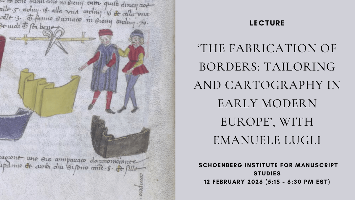
Join the Schoenberg Institute for Manuscript Studies for Emanuele Lugli’s lecture, “The Fabrication of Borders”. Professor Lugli will explore the interconnected evolution of fashion and cartography in early modern Europe.
Tag Archives: Cartography
Online Lecture: ‘All the Stage’s a World: Vernacular Cartography and the Castle of Perseverance’ with Dr. John Wyatt Greenlee, 10 March 2021 at 5:00pm (EST)

The Medieval Studies program at The Graduate Center of the City University of New York (CUNY) invites you to an online lecture by Dr. John Wyatt Greenlee on 10 March 2021 at 5:00pm EST. Dr. Greenlee is a medieval cartographic historian. His research is primarily driven by questions of how people perceive and reproduce theirContinue reading “Online Lecture: ‘All the Stage’s a World: Vernacular Cartography and the Castle of Perseverance’ with Dr. John Wyatt Greenlee, 10 March 2021 at 5:00pm (EST)”
New Publication: Christian Maps of the Holy Land: Images and Meanings, by Pnina Arad

This book offers a way of reading maps of the Holy Land as visual imagery with religious connotations. Through a corpus of representative examples created between the sixth and the nineteenth centuries, it studies the maps as iconic imagery of an iconic landscape and analyses their strategies to manifest the spiritual quality of the biblical topography, to support religious tenets, and to construct and preserve cultural memory.
CFP: Art and its Directions (Perth, 6-8 Dec 17)
Perth, University of Western Australia, December 6 – 08, 2017 Deadline: May 22, 2017 The Conference Committee would like to invite proposals for panel sessions for the AAANZ 2017 Conference in Perth. The deadline for session proposals is COB Monday 22 May 2017. Please see the submission instructions below. All enquiries to conf@aaanz.info. CONFERENCE THEME | ART AND ITS DIRECTIONSContinue reading “CFP: Art and its Directions (Perth, 6-8 Dec 17)”
New Publications: Body-Worlds: Opicinus de Canistris and the Medieval Cartographic Imagination
Body-Worlds: Opicinus de Canistris and the Medieval Cartographic Imagination Author: K. Whittington Brepols Publishers In 1334, an Italian priest named Opicinus de Canistris fell ill and experienced a divine vision of continents and oceans transformed into human figures, a vision which inspired numerous drawings. While they relate closely to contemporary maps and seacharts, religious iconography,Continue reading “New Publications: Body-Worlds: Opicinus de Canistris and the Medieval Cartographic Imagination”
Upcoming Event: London Medieval Society Meeting- Forging Ahead (November 14, 2015)
The first London Medieval Society Colloquium of the new academic year welcomes Dr Alfred Hiatt as the Society’s new President. To celebrate the program explores themes central to his research: – Medieval Forgeries, Medieval Maps, Places and Spaces Speakers are: Catherine Delano-Smith on understanding medieval maps; Leonie Hicks on medieval voyaging; Marianne O’Doherty on medieval ideas of the Indian Ocean;Continue reading “Upcoming Event: London Medieval Society Meeting- Forging Ahead (November 14, 2015)”
Call for Papers: Cartography between Europe and the Islamic World 1100 – 1600 (London 2014)
Call for Papers Cartography between Europe and the Islamic World 1100 – 1600 London, Queen Mary, University of London, September 8-9, 2014 Deadline: 21 February 2014 The Leverhulme Network ‘Cartography between Europe and the Islamic World’ aims to promote comparative, cross-disciplinary scholarship on Islamic and European cartography by bringing together experts in these two fields forContinue reading “Call for Papers: Cartography between Europe and the Islamic World 1100 – 1600 (London 2014)”
